March 31, 2016
By David Conway
Easy ways to find currents and eddies offshore.
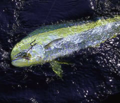
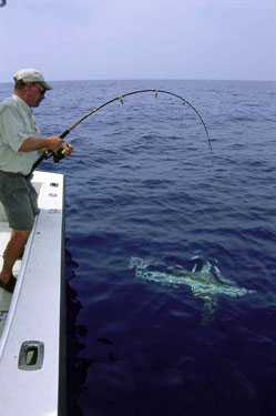
Dolphin forage for food along bluewater frontal breaks. |
Tracking weather fronts has long been a big part of offshore fishing. Pretty easy, too. Just turn on the TV or check the Internet. No excuse for getting caught in a norther on your way to the marlin grounds.
But there are fronts of another sort that are just as much a part of planning for a successful bluewater run.
Ocean frontal zones—the leading edges of current flows—are what concentrate bait, draw predators and make hotspots hot. This is where rips, weedlines and color changes begin.
Until a few years ago, the day-to-day movements of ocean fronts remained a mystery to everyone except oceanographers and full-time fishermen. But now, thanks to satellite and computer technology, information about currents and sea temperatures is easy to come by. Maybe not so easy as flipping on the TV, but darn close.
“It's amazing that now so much of our fishing depends on knowing the movements of the Gulf Stream and watching its eddies and backflows,” said Rick Ryals of Jacksonville, bluewater veteran and director of the Florida Sportsman Live radio network. “Only 15 years ago, we never even paid attention to currents, except to watch for weedlines. It's the satellite technology that has made it possible for us to know what's going on out there, and it's invaluable information for knowing where to fish. It shows you pockets of water temperatures, rips, weed concentrations, and more or less tells you where to fish.”
As currents snake and meander through the oceans, they spin off eddies, backflows and fingers. The leading edges of these formations, called fronts, create most of the phenomena that we look for offshore—the rips, color changes and weed and debris accumulations. Frequently, there's a temperature difference between bodies of water—a curtain beyond which certain bluewater species will not go. Along the Florida Keys, for instance, a convergence of 78-degree blue water from a finger of the Gulf Stream and 74-degree outflow from the Gulf means a good chance of finding sailfish and cobia.
Dr. Mitchell A. Roffer, Ph.D. and president of Roffer's Ocean Fishing Forecasting Service, based in Miami, says, “Certain fish like mahi, marlin, swordfish, yellowfin and other tunas travel along the edge of the Gulf Stream and feed along the Gulf Stream frontal zones. Not only are the eastern boundary and western boundary productive, the eddies along both sides are productive. We have also seen eddies in the middle of the Gulf Stream that have increased productivity.”
Fronts also carry and accumulate weeds and debris at their leading edges that provide structure. One favorite example is sargassum weed, and with it dolphin, that the fronts of the Gulf Stream carry to us through the summer.
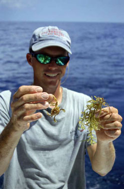
Small crabs and other forage live in sargassum weed. |
In addition to debris, the fronts carry and concentrate phytoplankton, zooplankton and baitfish at their leading edges. According to Dr. Chris Mooers, of University of Miami's Rosenstiel School of Marine and Atmospheric Sciences, “All those organisms get pushed by the force of that water to the leading edge, and that is where they stay, caught and bounded by the movements of the water that carries them. In turn, that's where the pelagics hunt for prey.”
Fronts also mark the bounds of different kinds of ocean water. Coastal water is usually cooler, less salty, and richer in those nutrients (that give it a cloudier color) than blue water, and those variations create density differences that prevent the two waters from mixing. The boundary where they meet, seen as a color change, can last for days and start a feeding chain along its edge.
“If,” Roffer adds, “the organisms remain concentrated along the front for 24 to 48 hours or more, there will be a substantial concentration for larger fish to locate and feed on.”
That's the kind of hotspot that a knowing angler might find at home via computer by checking temperature breaks on sea surface temperature charts.
According to Roffer, those spots last anywhere from a day to seven days. After that time, the ocean's circulation changes will mix the surrounding waters, dispersing bait and predators.
Eddies might contain many or all of these attractive features along their edges, and in themselves make fishing destinations in the open ocean. Eddies might be created by a current's movement, or develop from friction between a current and a land mass, or from friction between two currents, or even by disruption of a current's flow over massive seamounts, such as the so-called Steps off Florida's west coast. In any case, according to Mooers, eddies are strongly manifested in satellite imagery—both thermal and color imagery.
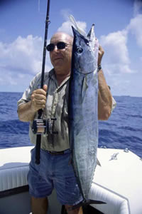
Wahoo gravitate to baits run deeper in the water column. |
At sea, eddies are apparent by the change in current direction and speed in their water, and likely a change in the ripple pattern and even in the water color, said Mooers. However, unless anglers know that they have found an eddy, and how large it might be, their discovery will be much less valuable because many won't know how to approach and fish it.
“Shallow eddies stretch about 5 to 10 kilometers in diameter,” Mooers explained, “and deep eddies may reach 100 kilometers in diameter.”
Most anglers prefer trolling in the same direction as the eddy's current since natural baits travel with the current flow. Edges might produce fish, but depending on the eddy's size and your time constraints, it may also prove effective to explore toward the eddy's center to discover its most productive features and areas and then to begin fishing.
Counter-clockwise-rotating eddies, called cyclonic eddies in the northern hemisphere, and also known as cold-core, upwelling eddies, can become hotspots by creating the ultimate offshore oasis.
In them, as Roffer explained, “the rotation of water results in an outward flow, and
this forces subsurface water up to replace water moving outward.”
These upwelling eddies bring nutrients and phytoplankton up from the sea floor toward the sunlight, which stimulates their growth. “In turn,” said Roffer, “this brings zooplankton to feed, and then bait and predators. In Florida however, the core does not always get colder at the surface due to the upwelling. Sometimes the increase in productivity remains deeper in the water column and does not appear to affect the surface action with tuna, wahoo, marlin and mahi, but swordfish action is likely to improve in either case because they feed at the lower depths.”
Some anglers check reports of temperature breaks and current flows on Web sites as often as others check the weather forecast in an effort to learn the patterns of circulation in their home waters. After all, oceans operate in a system similar to the earth's atmosphere, constantly moving and shifting in unstable, but predictable patterns. Some Web sites have GPS coordinate overlay grids that give approximate locations of eddies, temperature breaks and other formations, but subscription services like Roffer's take out the guesswork by pinpointing their coordinate locations.
In the Keys, the Gulf Stream swings anywhere from 10 to 50 miles offshore, and its strength varies plus or minus 30 percent of its total strength, according to Mooers. As it moves, fingers, backflows and eddies from it carry pelagics even closer to the islands, but knowing how to take advantage of the current's positioning also requires knowledge of each species' habits and preferences for water temperatures.
In the Jacksonville area, Ryals noted that, “The Gulf Stream is the driving motor that pushes currents. In the spring, we look for warm-water eddies off the Stream where pelagics congregate, since surrounding water remains cold. We lie awake at night and dream about times when the western wall of the Gulf Stream lines up directly on top of the continental shelf, 50 miles out. That produces exceptional bluewater trolling, and also extraordinary bottom fishing for grouper and big red snapper. These conditions exist in April, May and June.
“For bottom fishing,” Ryals continued, “when the water within 40 miles of the beach is too cold and the western edge of the Stream lines up over the continental shelf, it draws all the bottom fish out there and concentrates them into a smaller area. Not only will we get limits of 15- to 30-pound red snapper, we'll also catch big scamp and gag grouper. And tropical species—yellowtail, mutton snapper, Nassau grouper, and queen triggerfish, too.”
Along the Central West Coast, the offshore fishery's three most dominant features, according to Tom Verdensky, president of the Old Salt Fishing Club in Madeira Beach, are the Loop Current, the overflow from the Mississippi River Delta runoff, and The Steps.
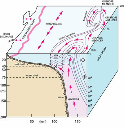
Schematic demonstrates how a counter-clockwise frontal eddy diverges from the north-bound Florida Current. At times cool, nutrient-rich bottom water is drawn into such a feature. |
The Loop Current, which swings up the Gulf from the Caribbean, brings major pelagics to the region, including billfish, swordfish and schools of yellowfin tuna that take up residence in the nutrient-rich waters of the Mississippi runoff and nearby oil rigs there. The Loop moves in and out, usually staying a hundred miles or so off the Central West Coast, but it produces break-off currents, weedlines, bait concentrations and eddies that dominate the region's offshore fishery.
The Mississippi overflow contains runoff from the Delta region, as well as major debris fields. In the basic scenario, the runoff trickles through the Gulf, gets caught by the Loop Current, and brings nutrient-rich waters, debris and fish down the coast.
“It's amazing how far that overflow comes down,” says Verdensky. “There are some environmental negatives to its waters, like runoff from the agricultural lands up there, but it also contains great habitat for fish, like entire trees floating on the surface.”
Sharks often prowl this prime "real estate." |
Verdensky, and others in his area, depend on marine forecasting services to locate the edges of these currents, and their associated debris fields, before they make long, 70- to 100-mile runs to fish.
“You can look directly at satellite readings from NOAA, but you really need expert knowledge to interpret that data,” says Verdensky. “With the subscription services, you get exact data about debris, bait, and the formations and movements of the currents.
“A couple years ago, we had a phenomena where the Loop came in close, about 50 miles, but that is rare. It's our major bluewater source, and we run out to it in our tournaments. In August, we'll go for the big yellowfin and billfish, and also for big kings. Also, it's nice to see the Gulf swordfishery coming back, and they move with the Loop Current, too.
“Our other major offshore feature is The Steps,” Verdensky said, “which are deep drops of 400, followed by 300 feet, and they create huge upwellings that concentrate bait and pelagics.”
The free-access ocean charts, posted on Web sites often sponsored by government and university agencies, and the subscription services, all use data produced by NOAA satellites, and complex computer programs to transform it into sea surface temperatures.
The most sophisticated services use visual information from the NASA Terra and Aqua satellites, and they combine all that data with radar, sea buoy, ship, weather and angler reports to create current-flow and sea temperature forecasts.
Ocean currents and eddies do more than bring fish our way. Our currents in Florida, the Loop, the Gulf Stream, and others that occasionally flow near, are all interconnected to a worldwide circulatory system that continually transports nutrients through the oceans, balances the earth's temperatures, and serves to keep the planet, and all life on it, thriving. With the stores of knowledge available at our fingertips, the ways of the ocean and its currents need not be quite so mysterious anymore.
How the Wizardry Works
How forecasters turn satellite data into offshore reports gives a glimpse into the amazing world of marine sciences.
“Most commercial producers of sea surface information use data produced by the polar orbiter satellites,” says John Sapper, of NOAA's NESDIS branch (National Environmental Satellit
e Data and Information Services; www.noaasis.noaa.gov/NOAASIS/). “Radiometers aboard those satellites sense radiation at the sea surface in infrared wavelengths, which is basically heat. Each radiometer is like a spinning telescope that gets a picture of a wide swath of earth. The satellites collect that data on board and send it down when they pass over receiver stations on land,” Sapper says. “This technology to receive the information can be purchased privately, depending on its application.”
That information is in engineering values, and it must be translated, by computer software, into actual sea surface temperature values.
“There's a complex process used to produce translations and screen out for cloud cover, and account for water vapor, among other variables,” Sapper says. “We then must tune those temperatures to known values produced by sea buoys to create a map of accurate sea temperatures across a wide expanse of ocean.
“We'll take many readings over short periods, and we'll produce a kind of analysis, or composite picture over a particular time period. It can be for a couple of days, or for a week, or you might see an instantaneous picture of sea surface temperatures. Near coasts and especially around the Gulf Stream, temperatures change much more quickly than in the open ocean, and a week's composite picture will be outdated for most angling purposes.”
What's on the horizon for satellite-based technologies?
“A new series of polar orbiting satellites will be launched in 2007 that will provide even higher resolution images than we have now,” Sapper says. “This imagery will pinpoint eddies and temperature breaks much more accurately, and will give us high-resolution images globally, whereas now, we only have high-resolution imagery in a few locations.”
So reports are going to keep getting better, or at least, more accurate.
Some Sources
Valuable information on currents, eddies and associated features can be found at the following Web sites:
www.roffs.com
www.nowcoast.noaa.gov
www.efsis.rsmas.miami.edu
www.sstcharts.com
www.terra.nasa.gov/
www.aqua.nasa.gov/
www.noaasis.noaa.gov/NOAASIS/
FS
